
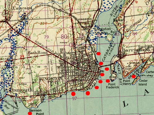
1924 Oblique Air Photos of Kingston
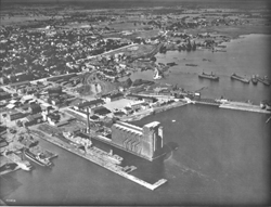
The weather outlook for Thursday September 25, 1924 called for light to moderate winds, fair and cool. It would be a favourable day for an unknown photographer to fly in a small aeroplane along the Kingston waterfront from Lake Ontario Park to Old Fort Henry and then north along the Cataraqui River to Bell Isle. Although the image quality varies considerably in these old photographs, the University, the Hospital, the Fort, Royal Military College, and the Penitentiary are clearly evident.
Move your cursor along the shoreline of the map below and click on any red marker.
To download a copy of the image, right-click it and choose Save Picture As...
Example (at reduced scale)
The original photos were taken on Thursday, September 25, 1924. The flightline is irregular along the lakefront from West to East to North. Their nominal scale is 1:15,000 but since the photographs are shot at varying oblique angles, scale is inconsistent overall. Focal length is 12". The black and white photographs in the collections of Queen's University Library are printed in grey scale on 10" x 10" paper. The actual images are often irregular and may be printed smaller than 9" x 9". The negatives are held by the National Air Photo Library in Ottawa.
Scanning was done at 600 dpi in 8-bit depth gray scale. The scanned images were saved as uncompressed TIFF files and then compressed to JPEG files for this web page. These compressed JPEG images range in size from 3 to 9 megabytes. Although these images are quite legible on a standard computer monitor, much more detail is available if the files are downloaded to your computer and then opened in a standard imaging program.
Other than normal copyright considerations, there are no restrictions to use.
Last Updated: 06 May 2015