Hours
Please refer to the Stauffer Library page for Maps & Air Photos hours.
About
The Map and Geospatial Data Collection focuses on the local area and on Canadian material, and currently comprises over 101,000 maps, 1,900 books and atlases, 45,000 air photos, and 1,000s of licensed digital map and image files.
The collection includes:
Air Photos
The air photo collection emphasizes Kingston and the surrounding southeastern Ontario area but imagery covering other areas of Ontario, Canada and the world is also available.
Paper
The library catalogue Omni and Air Photo Holdings (*new* interactive map) include records for all photographs in our collections, and are complemented by paper flight line index maps annotated with our photograph holdings.
Digital (orthophotography, satellite data, etc.)
The fastest growing part of the collection. Search the Scholars GeoPortal to get an idea of the extent of coverage in this format. The Library is also the Queen's University liaison with Land Information Ontario
Maps & Historical Cartography
Supplementing a core collection of current and historical Canadian topographic maps are detailed and medium scale topographic maps of many areas in the world, historic and modern city plans, nautical charts of Canadian waterways, soil surveys, past and current census and administrative boundary maps, facsimiles of early maps, and much more. We have an exceptional collection of early mapping of Kingston and the surrounding area, in reproduction or facsimiles.
Atlases & Books
Books and journals on cartography and related subjects, international, national and regional atlases, thematic atlases, historical atlases in facsimile, cartographic bibliographies and catalogues, and gazetteers are well represented in the Collection. Of special note is the portion of the Collection dedicated to Dr. Richard Ruggles who, in support of teaching and research, began gathering materials pertinent to the study of the history of cartography.
Services
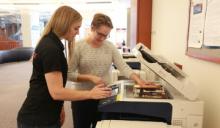
Walk-in Information Assistance
Staff can help you acquire geospatial data for your GIS, get started in using the data in GIS software, find maps and photographs, use the scanners, and much more. Please ask!
Course Support, Classes, Workshops and Tours
In-house reserve of materials, thematic displays, tours and special instruction sessions relevant to a particular course or research interest can be arranged at any time.
Circulation
In general, maps, air photos, atlases, and globes do not circulate, except for instructional purposes.
Equipment
Workstations with GIS and graphics software, a networked 11* x 17* colour scanner, a light table, camera copy stand, and pocket and mirror stereoscopes are amongst the equipment available.